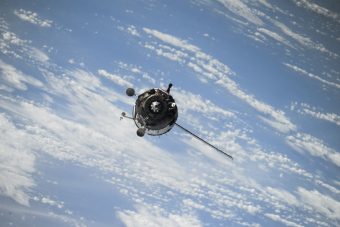
A SpaceX Falcon Heavy rocket launched the GEOS-U satellite into orbit on June 25 from NASA’s Kennedy Space Center in Florida. According to the World Meteorological Organization (WMO), it is expected to reach geostationary orbit, 22,236 miles above Earth, in about two weeks.
This satellite will be named GEOS-19 and is part of the GEOS-R series of geostationary operational environmental satellites, the most advanced weather and environmental monitoring system in the Western Hemisphere. Precisely, as stated on the National Oceanic and Atmospheric Administration (NOAA) website, it is positioned to monitor environmental hazards affecting much of North America, including the continental United States and Mexico, as well as Central and South America, the Caribbean, and the Atlantic Ocean up to the west coast of Africa.
The GEOS-U satellite, with its proactive approach, will provide crucial data for protecting the Western Hemisphere from environmental threats, offering early warnings and enabling timely responses.
Ken Graham, director of NOAA’s National Weather Service, explained that GEOS is one of the most valuable tools in meteorologists’ and hydrologists’ observational arsenals.
More:
- NASA LAUNCHES SMALL CLIMATE SATELLITE TO STUDY EARTH’S POLES
- SATELLITES IN THE SERVICE OF ECONOMIC AND ENVIRONMENTAL OPPORTUNITIES
- HOW CAN SATELLITES AND ARTIFICIAL INTELLIGENCE REDUCE METHANE EMISSIONS?
The satellite will provide essential data for identifying and monitoring environmental hazards, pinpointing fire hotspots, detecting changes in fire behavior, and assessing its movement and intensity. Additionally, it will monitor smoke emissions and their effects on air quality. Moreover, the satellite can identify lightning strikes that may lead to fires.
Benefits include early warnings for tropical storms and hurricanes and providing data on storm characteristics. It will also detect heavy rainfall and offer warnings of flash flood risks.
We must also mention space weather information caused by solar activities, such as solar storms. These storms can impact Earth through magnetic fields and solar particles, potentially disrupting power grids and communication and navigation systems. The satellite will indeed detect dangerous space weather.
GEOS-U is the fourth and final NOAA satellite in the GEOS-R series. It will operate in synchronization with GEOS-18 and cover more than half of the planet Earth – from New Zealand to the west coast of Africa and from near the Arctic Circle to the Antarctic Circle.
Energy portal

